
Wan Chai District topographic map
Interactive map
Click on the map to display elevation.
About this map
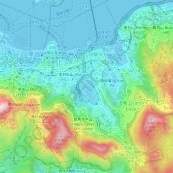
Name: Wan Chai District topographic map, elevation, terrain.
Location: Wan Chai District, Hong Kong, PRC (22.25404 114.16316 22.29376 114.20722)
Average elevation: 122 m
Minimum elevation: -3 m
Maximum elevation: 425 m
Other topographic maps
Click on a map to view its topography, its elevation and its terrain.