
Eastern District topographic map
Interactive map
Click on the map to display elevation.
About this map
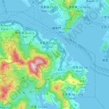
Name: Eastern District topographic map, elevation, terrain.
Location: Eastern District, Hong Kong, PRC (22.24584 114.18622 22.30076 114.26101)
Average elevation: 84 m
Minimum elevation: -6 m
Maximum elevation: 513 m
Other topographic maps
Click on a map to view its topography, its elevation and its terrain.