
Thank you for supporting this site ❤️
Make a donation
Make a donation
Gear up for your next adventure:
As an Amazon Associate, this site earns from qualifying purchases at no extra cost to you.
Kalasa topographic map
Click on the map to display elevation.
Thank you for supporting this site ❤️
Make a donation
Make a donation
Gear up for your next adventure:
As an Amazon Associate, this site earns from qualifying purchases at no extra cost to you.
About this map
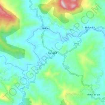
Name: Kalasa topographic map, elevation, terrain.
Location: Kalasa, Kalasa taluk, Chikkamagaluru, Karnataka, 577124, India (13.19222 75.31824 13.27222 75.39824)
Average elevation: 897 m
Minimum elevation: 747 m
Maximum elevation: 1,447 m
Thank you for supporting this site ❤️
Make a donation
Make a donation
Gear up for your next adventure:
As an Amazon Associate, this site earns from qualifying purchases at no extra cost to you.