Geolocate

Saint Vith topographic map

Click on the map to display elevation.

About this map
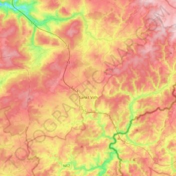
Name: Saint Vith topographic map, elevation, terrain.

Location: Saint Vith, Verviers, Liège, Wallonia, 4780, Belgium (50.23011 5.97866 50.35284 6.30903)

Average elevation: 492 m

Minimum elevation: 287 m

Maximum elevation: 648 m

Other topographic maps

Click on a map to view its topography, its elevation and its terrain.

Andler

Belgium > Liège > Verviers > Saint Vith

Average elevation: 497 m

Gear up for your next adventure:

🍖Freeze-Dried Trail Meals - Nutritious and lightweight food for expeditions
🧦Merino Wool Socks - Moisture-wicking and blister-preventing trail socks
🌍Travel Adapters - Adapters for international travel
🪑Compact Camp Chairs - Comfortable seating after a long day of mapping
📈Fitness Trackers - Monitor activity and hike metrics

As an Amazon Associate, this site earns from qualifying purchases at no extra cost to you.