
Thank you for supporting this site ❤️
Make a donation
Make a donation
Gear up for your next adventure:
As an Amazon Associate, this site earns from qualifying purchases at no extra cost to you.
Tehuixtla topographic map
Click on the map to display elevation.
Thank you for supporting this site ❤️
Make a donation
Make a donation
Gear up for your next adventure:
As an Amazon Associate, this site earns from qualifying purchases at no extra cost to you.
About this map
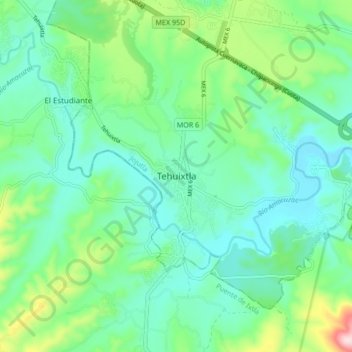
Name: Tehuixtla topographic map, elevation, terrain.
Location: Tehuixtla, Jojutla, Morelos, 62910, Mexico (18.52049 -99.31062 18.60049 -99.23062)
Average elevation: 916 m
Minimum elevation: 831 m
Maximum elevation: 1,184 m
Thank you for supporting this site ❤️
Make a donation
Make a donation
Gear up for your next adventure:
As an Amazon Associate, this site earns from qualifying purchases at no extra cost to you.