
Thank you for supporting this site ❤️
Make a donation
Make a donation
Gear up for your next adventure:
As an Amazon Associate, this site earns from qualifying purchases at no extra cost to you.
Königswiesen topographic map
Click on the map to display elevation.
Thank you for supporting this site ❤️
Make a donation
Make a donation
Gear up for your next adventure:
As an Amazon Associate, this site earns from qualifying purchases at no extra cost to you.
About this map
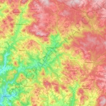
Name: Königswiesen topographic map, elevation, terrain.
Location: Königswiesen, Bezirk Freistadt, Upper Austria, 4280, Austria (48.33653 14.76893 48.46455 14.93504)
Average elevation: 734 m
Minimum elevation: 484 m
Maximum elevation: 949 m
Thank you for supporting this site ❤️
Make a donation
Make a donation
Gear up for your next adventure:
As an Amazon Associate, this site earns from qualifying purchases at no extra cost to you.