
Make a donation
Gear up for your next adventure:
As an Amazon Associate, this site earns from qualifying purchases at no extra cost to you.
Körbersee topographic map
Click on the map to display elevation.
Make a donation
Gear up for your next adventure:
As an Amazon Associate, this site earns from qualifying purchases at no extra cost to you.
Körbersee
Der Körbersee befindet sich südwestlich des Hochtannbergpasses im österreichischen Bundesland Vorarlberg im Gemeindegebiet von Schröcken. Er liegt im Lechquellengebirge auf einer Höhe von 1654 m ü. A. und kann nur zu Fuß erreicht werden.
Make a donation
Gear up for your next adventure:
As an Amazon Associate, this site earns from qualifying purchases at no extra cost to you.
About this map
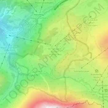
Name: Körbersee topographic map, elevation, terrain.
Average elevation: 1,654 m
Minimum elevation: 1,193 m
Maximum elevation: 2,334 m
Make a donation
Gear up for your next adventure:
As an Amazon Associate, this site earns from qualifying purchases at no extra cost to you.