
چاہ سلطان topographic map
Interactive map
Click on the map to display elevation.
About this map
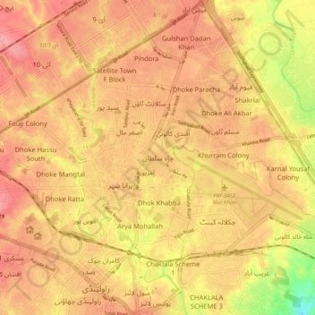
Name: چاہ سلطان topographic map, elevation, terrain.
Location: چاہ سلطان, راولپنڈی سٹی, ضلع راولپنڈی, Panyab, 46300, Pakistán (33.58445 73.03243 33.66445 73.11243)
Average elevation: 506 m
Minimum elevation: 446 m
Maximum elevation: 534 m