
Thank you for supporting this site ❤️
Make a donation
Make a donation
Gear up for your next adventure:
As an Amazon Associate, this site earns from qualifying purchases at no extra cost to you.
Bo'ness topographic map
Click on the map to display elevation.
Thank you for supporting this site ❤️
Make a donation
Make a donation
Gear up for your next adventure:
As an Amazon Associate, this site earns from qualifying purchases at no extra cost to you.
About this map
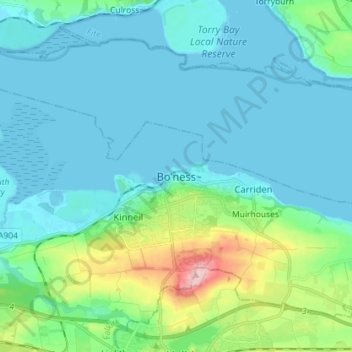
Name: Bo'ness topographic map, elevation, terrain.
Location: Bo'ness, Falkirk, Scotland, EH51 9AB, United Kingdom (55.97769 -3.64736 56.05769 -3.56736)
Average elevation: 29 m
Minimum elevation: -1 m
Maximum elevation: 170 m
Thank you for supporting this site ❤️
Make a donation
Make a donation
Gear up for your next adventure:
As an Amazon Associate, this site earns from qualifying purchases at no extra cost to you.