
Icmeler topographic map
Interactive map
Click on the map to display elevation.
About this map
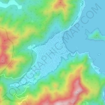
Name: Icmeler topographic map, elevation, terrain.
Location: Icmeler, Marmaris, Muğla, Aegean Region, 48720, Turkey (36.78014 28.20811 36.82014 28.24811)
Average elevation: 152 m
Minimum elevation: -1 m
Maximum elevation: 548 m
Other topographic maps
Click on a map to view its topography, its elevation and its terrain.