Geolocate

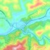
Bandy topographic map

Click on the map to display elevation.

About this map
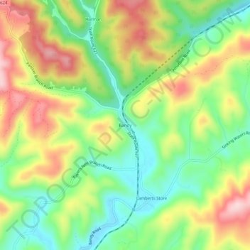
Name: Bandy topographic map, elevation, terrain.

Location: Bandy, Tazewell County, Virginia, United States (37.12289 -81.72095 37.16289 -81.68095)

Average elevation: 734 m

Minimum elevation: 625 m

Maximum elevation: 874 m

Other topographic maps

Click on a map to view its topography, its elevation and its terrain.
Cedar Bluff

United States > Virginia > Tazewell County

Average elevation: 673 m

Gratton

United States > Virginia > Tazewell County > Gratton

Average elevation: 959 m

Richlands

United States > Virginia > Tazewell County

Average elevation: 671 m

Bluefield

United States > Virginia > Tazewell County

Average elevation: 849 m

Cedar Bluff

United States > Virginia > Tazewell County

Average elevation: 673 m

Gear up for your next adventure:

🧉Camping Coffee Gear - Enjoy coffee outdoors
🔥Camping Stoves - Portable camping stoves for outdoor cooking
⛺Ultralight Hiking Tents - Compact shelters for multi-day wild camping in Ireland
🧭Route Planning Books - Plan the best hiking routes
🥘Camping Cookware Sets - Cookware sets for backpacking meals

As an Amazon Associate, this site earns from qualifying purchases at no extra cost to you.