
South Moreau Creek topographic map
Interactive map
Click on the map to display elevation.
About this map
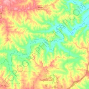
Name: South Moreau Creek topographic map, elevation, terrain.
Location: South Moreau Creek, Cole County, Missouri, United States (38.45070 -92.43960 38.50022 -92.30598)
Average elevation: 225 m
Minimum elevation: 180 m
Maximum elevation: 281 m
Other topographic maps
Click on a map to view its topography, its elevation and its terrain.
Jefferson City
United States > Missouri > Cole County > Jefferson City
Jefferson City, Cole County, Missouri, United States
Average elevation: 203 m