
Thank you for supporting this site ❤️
Make a donation
Make a donation
Gear up for your next adventure:
As an Amazon Associate, this site earns from qualifying purchases at no extra cost to you.
Kasarsai topographic map
Click on the map to display elevation.
Thank you for supporting this site ❤️
Make a donation
Make a donation
Gear up for your next adventure:
As an Amazon Associate, this site earns from qualifying purchases at no extra cost to you.
About this map
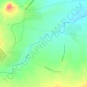
Name: Kasarsai topographic map, elevation, terrain.
Location: Kasarsai, Nere, Mulshi, Maharashtra, 412101, India (18.62388 73.67752 18.63708 73.69648)
Average elevation: 605 m
Minimum elevation: 578 m
Maximum elevation: 647 m
Thank you for supporting this site ❤️
Make a donation
Make a donation
Gear up for your next adventure:
As an Amazon Associate, this site earns from qualifying purchases at no extra cost to you.