
Waterloo topographic map
Interactive map
Click on the map to display elevation.
About this map
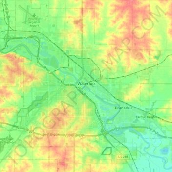
Name: Waterloo topographic map, elevation, terrain.
Location: Waterloo, Black Hawk County, Iowa, United States (42.42116 -92.43682 42.57049 -92.24886)
Average elevation: 272 m
Minimum elevation: 246 m
Maximum elevation: 307 m
The average elevation of Waterloo is 846 feet above sea level. The population density is 1101 people per square mile, considered low for an urban area.