Geolocate

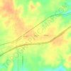
Rising Star topographic map

Click on the map to display elevation.

About this map

Name: Rising Star topographic map, elevation, terrain.

Location: Rising Star, Eastland County, Texas, United States (32.08831 -98.97830 32.10697 -98.95488)

Average elevation: 503 m

Minimum elevation: 490 m

Maximum elevation: 522 m

Other topographic maps

Click on a map to view its topography, its elevation and its terrain.
Union Center

United States > Texas > Eastland County

Average elevation: 489 m

Olden

United States > Texas > Eastland County

Average elevation: 472 m

Olden

United States > Texas > Eastland County

Average elevation: 472 m

Ranger

United States > Texas > Eastland County

Average elevation: 455 m

Gear up for your next adventure:

🚶‍♂️Trekking Poles - Supportive poles for stability on varied terrain
🔦High-Lumen Headlamps - Hands-free lighting for early starts or late finishes
🧴Long-Lasting Sunscreen - Protect against UV rays during long days on the ridges
🪶Ultralight Tents - Lightweight shelters for hikers
👖Zip-off Hiking Pants - Adapt to changing Irish temperatures quickly

As an Amazon Associate, this site earns from qualifying purchases at no extra cost to you.