
Thank you for supporting this site ❤️
Make a donation
Make a donation
Gear up for your next adventure:
As an Amazon Associate, this site earns from qualifying purchases at no extra cost to you.
Largs topographic map
Click on the map to display elevation.
Thank you for supporting this site ❤️
Make a donation
Make a donation
Gear up for your next adventure:
As an Amazon Associate, this site earns from qualifying purchases at no extra cost to you.
About this map
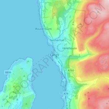
Name: Largs topographic map, elevation, terrain.
Location: Largs, North Ayrshire, Scotland, KA30 8LX, United Kingdom (55.75488 -4.90950 55.83488 -4.82950)
Average elevation: 110 m
Minimum elevation: -1 m
Maximum elevation: 449 m
Thank you for supporting this site ❤️
Make a donation
Make a donation
Gear up for your next adventure:
As an Amazon Associate, this site earns from qualifying purchases at no extra cost to you.