Geolocate

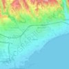
Limassol topographic map

Click on the map to display elevation.

About this map

Name: Limassol topographic map, elevation, terrain.

Location: Limassol, Limassol Municipality, Limassol District, Cyprus, 3085, Cyprus (34.52529 32.87327 34.84529 33.19327)

Average elevation: 176 m

Minimum elevation: -5 m

Maximum elevation: 1,046 m

Other topographic maps

Click on a map to view its topography, its elevation and its terrain.
Paphos Municipality

Cyprus > Cyprus

Average elevation: 57 m

Limassol

Cyprus > Cyprus > Limassol Municipality

Average elevation: 71 m

Gear up for your next adventure:

⛺Camping Tents - Top tents for Irish weather and conditions
🪑Compact Camping Tables - Tables for campsite comfort
🎧Wireless Earbuds - Music on the move
🧗Rock Climbing Gear - Essentials for the cliffs of Moher or Gap of Dunloe
🚲Cycling GPS Computers - Topographic mapping for Irish road and mountain biking

As an Amazon Associate, this site earns from qualifying purchases at no extra cost to you.