Geolocate

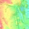
Pleasley topographic map

Click on the map to display elevation.

About this map

Name: Pleasley topographic map, elevation, terrain.

Location: Pleasley, Bolsover, Derbyshire, East Midlands, England, United Kingdom (53.16440 -1.26928 53.19970 -1.21562)

Average elevation: 141 m

Minimum elevation: 94 m

Maximum elevation: 182 m

Other topographic maps

Click on a map to view its topography, its elevation and its terrain.

Palterton

United Kingdom > England > Derbyshire > Bolsover

Average elevation: 133 m

Shuttlewood

United Kingdom > England > Derbyshire > Bolsover

Average elevation: 109 m

Pleasley Vale

United Kingdom > England > Derbyshire > Bolsover

Average elevation: 115 m

Newton

United Kingdom > England > Derbyshire > Bolsover

Average elevation: 143 m

Westhouses

United Kingdom > England > Derbyshire > Bolsover > Westhouses

Average elevation: 121 m

Upper Langwith

United Kingdom > England > Derbyshire > Bolsover

Average elevation: 112 m

Langwith

United Kingdom > England > Derbyshire > Bolsover

Average elevation: 99 m

Hodthorpe

United Kingdom > England > Derbyshire > Bolsover

Average elevation: 78 m

New Houghton

United Kingdom > England > Derbyshire > Bolsover

Average elevation: 149 m

Hilcote

United Kingdom > England > Derbyshire > Bolsover

Average elevation: 141 m

Gear up for your next adventure:

🧉Camping Coffee Gear - Enjoy coffee outdoors
⛺Ultralight Hiking Tents - Compact shelters for multi-day wild camping in Ireland
🥽UV Protection Sunglasses - Protect eyes on bright days
🔧Bicycle Repair Kits - On‑the‑go bike maintenance tools
🔒Outdoor Gear Locks - Secure your equipment

As an Amazon Associate, this site earns from qualifying purchases at no extra cost to you.