
Thank you for supporting this site ❤️
Make a donation
Make a donation
Gear up for your next adventure:
As an Amazon Associate, this site earns from qualifying purchases at no extra cost to you.
Compin topographic map
Click on the map to display elevation.
Thank you for supporting this site ❤️
Make a donation
Make a donation
Gear up for your next adventure:
As an Amazon Associate, this site earns from qualifying purchases at no extra cost to you.
About this map
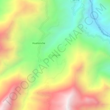
Name: Compin topographic map, elevation, terrain.
Location: Compin, Marmot, Gran Chimú, La Libertad, Perú (-7.71864 -78.64587 -7.67864 -78.60587)
Average elevation: 1,702 m
Minimum elevation: 1,045 m
Maximum elevation: 2,483 m
Thank you for supporting this site ❤️
Make a donation
Make a donation
Gear up for your next adventure:
As an Amazon Associate, this site earns from qualifying purchases at no extra cost to you.