
三鈷峰 topographic map
Interactive map
Click on the map to display elevation.
About this map
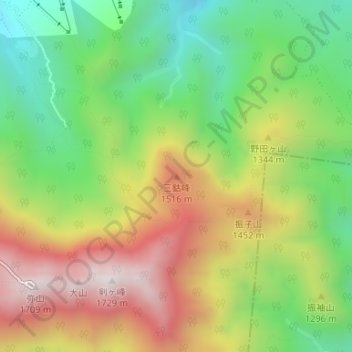
Name: 三鈷峰 topographic map, elevation, terrain.
Location: 三鈷峰, 大山町, 西伯郡, 鸟取县, 日本 (35.37919 133.55238 35.37929 133.55248)
Average elevation: 1,215 m
Minimum elevation: 820 m
Maximum elevation: 1,706 m