
Thank you for supporting this site ❤️
Make a donation
Make a donation
Gear up for your next adventure:
As an Amazon Associate, this site earns from qualifying purchases at no extra cost to you.
Tepetiltic topographic map
Click on the map to display elevation.
Thank you for supporting this site ❤️
Make a donation
Make a donation
Gear up for your next adventure:
As an Amazon Associate, this site earns from qualifying purchases at no extra cost to you.
About this map
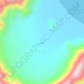
Name: Tepetiltic topographic map, elevation, terrain.
Location: Tepetiltic, San Pedro Lagunillas, Nayarit, Mexico (21.26373 -104.69976 21.26383 -104.69966)
Average elevation: 1,520 m
Minimum elevation: 1,419 m
Maximum elevation: 1,845 m
Thank you for supporting this site ❤️
Make a donation
Make a donation
Gear up for your next adventure:
As an Amazon Associate, this site earns from qualifying purchases at no extra cost to you.