
Thank you for supporting this site ❤️
Make a donation
Make a donation
Gear up for your next adventure:
As an Amazon Associate, this site earns from qualifying purchases at no extra cost to you.
Valdez topographic map
Click on the map to display elevation.
Thank you for supporting this site ❤️
Make a donation
Make a donation
Gear up for your next adventure:
As an Amazon Associate, this site earns from qualifying purchases at no extra cost to you.
About this map
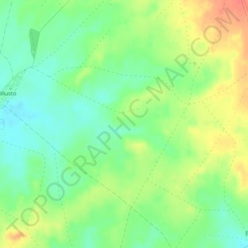
Name: Valdez topographic map, elevation, terrain.
Location: Valdez, Villadiego, Burgos, Castile and León, Spain (42.55077 -4.05211 42.57077 -4.03211)
Average elevation: 882 m
Minimum elevation: 861 m
Maximum elevation: 908 m
Thank you for supporting this site ❤️
Make a donation
Make a donation
Gear up for your next adventure:
As an Amazon Associate, this site earns from qualifying purchases at no extra cost to you.