
Thank you for supporting this site ❤️
Make a donation
Make a donation
Gear up for your next adventure:
As an Amazon Associate, this site earns from qualifying purchases at no extra cost to you.
Ulaan topographic map
Click on the map to display elevation.
Thank you for supporting this site ❤️
Make a donation
Make a donation
Gear up for your next adventure:
As an Amazon Associate, this site earns from qualifying purchases at no extra cost to you.
About this map
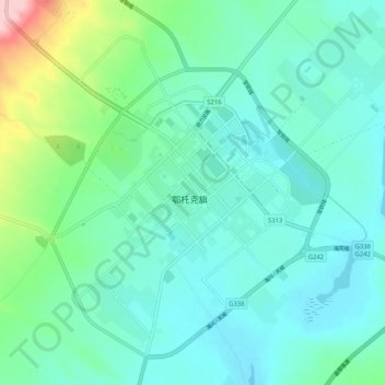
Name: Ulaan topographic map, elevation, terrain.
Location: Ulaan, 乌兰镇, Otog Banner, Ordos City, Inner Mongolia, China (39.05381 107.93835 39.13381 108.01835)
Average elevation: 1,386 m
Minimum elevation: 1,348 m
Maximum elevation: 1,544 m
Thank you for supporting this site ❤️
Make a donation
Make a donation
Gear up for your next adventure:
As an Amazon Associate, this site earns from qualifying purchases at no extra cost to you.