Geolocate

Maimuru topographic map

Click on the map to display elevation.

About this map

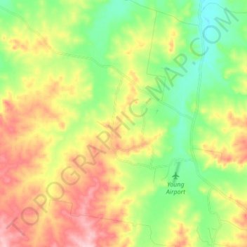
Name: Maimuru topographic map, elevation, terrain.

Location: Maimuru, Hilltops Council, New South Wales, 2594, Australia (-34.26430 148.11754 -34.20166 148.25400)

Average elevation: 424 m

Minimum elevation: 352 m

Maximum elevation: 520 m

Other topographic maps

Click on a map to view its topography, its elevation and its terrain.

Kerry Mountain

Australia > New South Wales

Average elevation: 949 m

Blue Mountains

Australia > New South Wales

A sandstone plateau dominated by a landscape of eucalyptus forests, the Blue Mountains are located at the top of a 470-million-year-old quartzite. In the Permian period, a shallow sea covered the region, when rivers brought shales, siltstones and mudstones. Then during the Mesozoic period, rivers dumped vast…

Average elevation: 566 m

Gungartan

Australia > New South Wales

Average elevation: 1,920 m

Mount Charles

Australia > New South Wales

Average elevation: 823 m

Bathurst

Australia > New South Wales

Average elevation: 760 m

Gear up for your next adventure:

🧺Quick-Dry Hiking Towels - Space-saving towels for wild swimming or camping
📸Travel Camera Tripods - Steady shots for landscape and long-exposure photos
🧴Long-Lasting Sunscreen - Protect against UV rays during long days on the ridges
🍁Eco‑Friendly Outdoor Products - Sustainable outdoor gear
Emergency Bivvy Bags - Life-saving heat-reflective shelter for emergencies

As an Amazon Associate, this site earns from qualifying purchases at no extra cost to you.