
Târgu Jiu topographic map
Interactive map
Click on the map to display elevation.
About this map
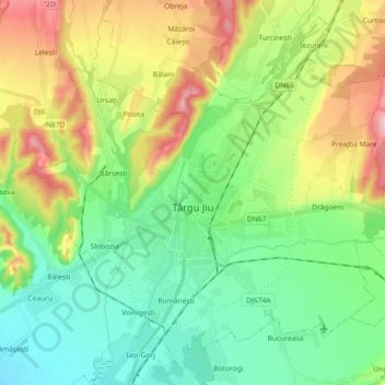
Name: Târgu Jiu topographic map, elevation, terrain.
Location: Târgu Jiu, Gorj, Romania (44.98841 23.20132 45.10527 23.38214)
Average elevation: 233 m
Minimum elevation: 170 m
Maximum elevation: 354 m
Other topographic maps
Click on a map to view its topography, its elevation and its terrain.