Geolocate

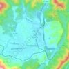
Fonde topographic map

Click on the map to display elevation.

About this map

Name: Fonde topographic map, elevation, terrain.

Location: Fonde, Bell County, Kentucky, 37851, United States (36.57425 -83.89742 36.61425 -83.85742)

Average elevation: 573 m

Minimum elevation: 380 m

Maximum elevation: 852 m

Other topographic maps

Click on a map to view its topography, its elevation and its terrain.
Middlesboro

United States > Kentucky > Bell County

Average elevation: 406 m

Pineville

United States > Kentucky > Bell County

Average elevation: 426 m

Middlesboro

United States > Kentucky > Bell County

Average elevation: 406 m

Pineville

United States > Kentucky > Bell County

Average elevation: 426 m

Middlesborough

United States > Kentucky > Bell County

Average elevation: 406 m

Gear up for your next adventure:

🧣Multi-functional Neckwear - Protect against wind and sun with versatile Buffs
🚶‍♂️Trekking Poles - Supportive poles for stability on varied terrain
🧥Waterproof Hiking Jackets - Rain jackets for unpredictable weather
👣Waterproof Leg Gaiters - Keep bog water and debris out of your boots
🔦High-Lumen Headlamps - Hands-free lighting for early starts or late finishes

As an Amazon Associate, this site earns from qualifying purchases at no extra cost to you.