
Thank you for supporting this site ❤️
Make a donation
Make a donation
Gear up for your next adventure:
As an Amazon Associate, this site earns from qualifying purchases at no extra cost to you.
Bortalao topographic map
Click on the map to display elevation.
Thank you for supporting this site ❤️
Make a donation
Make a donation
Gear up for your next adventure:
As an Amazon Associate, this site earns from qualifying purchases at no extra cost to you.
About this map
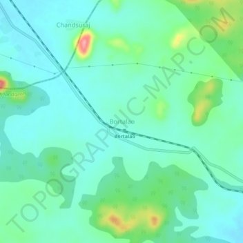
Name: Bortalao topographic map, elevation, terrain.
Location: Bortalao, Dongargarh Tahsil, Rajnandgaon, Chhattisgarh, India (21.19954 80.60565 21.23954 80.64565)
Average elevation: 414 m
Minimum elevation: 390 m
Maximum elevation: 496 m
Thank you for supporting this site ❤️
Make a donation
Make a donation
Gear up for your next adventure:
As an Amazon Associate, this site earns from qualifying purchases at no extra cost to you.