Geolocate

Junortoun topographic map

Click on the map to display elevation.

About this map
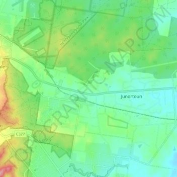
Name: Junortoun topographic map, elevation, terrain.

Location: Junortoun, Bendigo, City of Greater Bendigo, Victoria, 3551, Australia (-36.79946 144.31915 -36.74321 144.40061)

Average elevation: 209 m

Minimum elevation: 180 m

Maximum elevation: 247 m

Other topographic maps

Click on a map to view its topography, its elevation and its terrain.

Bendigo Creek

Australia > Victoria > Bendigo

Average elevation: 227 m

Sandhurst Reservoir

Australia > Victoria > Bendigo

Average elevation: 339 m

Bendigo Creek

Australia > Victoria > Bendigo

Average elevation: 223 m

Back Creek

Australia > Victoria > Bendigo

Average elevation: 188 m

Gear up for your next adventure:

🎒Day Packs - Perfect packs for day trips
🥾Lightweight Hiking Shoes - Light, breathable shoes for trail walking
🧥Gore-Tex Rain Jackets - Breathable and fully waterproof shells for Irish weather
🍽️Camping Utensil Sets - Complete eating sets
🩹Compact First Aid Kits - Treat blisters and minor injuries on the trail

As an Amazon Associate, this site earns from qualifying purchases at no extra cost to you.