
Make a donation
Gear up for your next adventure:
As an Amazon Associate, this site earns from qualifying purchases at no extra cost to you.
Country Club topographic map
Click on the map to display elevation.
Make a donation
Gear up for your next adventure:
As an Amazon Associate, this site earns from qualifying purchases at no extra cost to you.
About this map
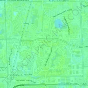
Name: Country Club topographic map, elevation, terrain.
Average elevation: 6 m
Minimum elevation: 1 m
Maximum elevation: 8 m
Make a donation
Gear up for your next adventure:
As an Amazon Associate, this site earns from qualifying purchases at no extra cost to you.
Other topographic maps
Click on a map to view its topography, its elevation and its terrain.
Hibiscus Point Mobile Home Park
United States > Florida > Miami-Dade County > Hialeah
Average elevation: 8 m
Strawberry Village Trailer Park
United States > Florida > Miami-Dade County > Hialeah
Average elevation: 6 m
Make a donation
Gear up for your next adventure:
As an Amazon Associate, this site earns from qualifying purchases at no extra cost to you.
Golden Glades
United States > Florida > Miami-Dade County > Hialeah > Golden Glades
Average elevation: 8 m