
Thank you for supporting this site ❤️
Make a donation
Make a donation
Gear up for your next adventure:
As an Amazon Associate, this site earns from qualifying purchases at no extra cost to you.
Valica topographic map
Click on the map to display elevation.
Thank you for supporting this site ❤️
Make a donation
Make a donation
Gear up for your next adventure:
As an Amazon Associate, this site earns from qualifying purchases at no extra cost to you.
About this map
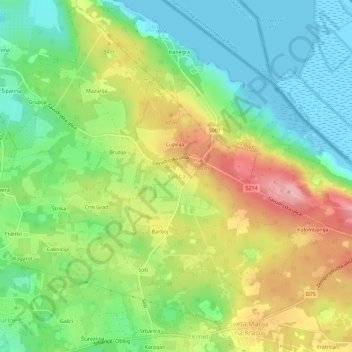
Name: Valica topographic map, elevation, terrain.
Location: Valica, Valica - Valiza, Grad Umag, Istria County, Croatia (45.44787 13.55002 45.48787 13.59002)
Average elevation: 53 m
Minimum elevation: -2 m
Maximum elevation: 128 m
Thank you for supporting this site ❤️
Make a donation
Make a donation
Gear up for your next adventure:
As an Amazon Associate, this site earns from qualifying purchases at no extra cost to you.