
Make a donation
Gear up for your next adventure:
As an Amazon Associate, this site earns from qualifying purchases at no extra cost to you.
North Ridgeville topographic map
Click on the map to display elevation.
Make a donation
Gear up for your next adventure:
As an Amazon Associate, this site earns from qualifying purchases at no extra cost to you.
About this map
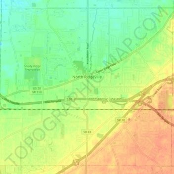
Name: North Ridgeville topographic map, elevation, terrain.
Location: North Ridgeville, Lorain County, Ohio, 44039, United States (41.35127 -82.06897 41.41891 -81.96998)
Average elevation: 225 m
Minimum elevation: 206 m
Maximum elevation: 243 m
Make a donation
Gear up for your next adventure:
As an Amazon Associate, this site earns from qualifying purchases at no extra cost to you.
Other topographic maps
Click on a map to view its topography, its elevation and its terrain.
Pine Ridge Trailer Park
United States > Ohio > Lorain County > North Ridgeville
Average elevation: 228 m
Make a donation
Gear up for your next adventure:
As an Amazon Associate, this site earns from qualifying purchases at no extra cost to you.