
Chathari topographic map
Interactive map
Click on the map to display elevation.
About this map
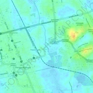
Name: Chathari topographic map, elevation, terrain.
Location: Chathari, Kochi, Ernakulam, Kerala, 682301, India (9.94883 76.35559 9.95135 76.35653)
Average elevation: 8 m
Minimum elevation: -4 m
Maximum elevation: 28 m
Other topographic maps
Click on a map to view its topography, its elevation and its terrain.
Periyar River
Periyar River, Kochi, Ernakulam, Kerala, 683108, India
Average elevation: 7 m
Mangalavanam Bird WLS
Mangalavanam Bird WLS, Mathai Manjooran Road, ietty, Kacheripady, Kochi, Ernakulam, Kerala, 682012, India
Average elevation: 4 m
Vallarpadam
Vallarpadam, Kochi, Ernakulam, Kerala, 682504, India
Average elevation: 2 m