
Make a donation
Gear up for your next adventure:
As an Amazon Associate, this site earns from qualifying purchases at no extra cost to you.
San Giovanni topographic map
Click on the map to display elevation.
Make a donation
Gear up for your next adventure:
As an Amazon Associate, this site earns from qualifying purchases at no extra cost to you.
About this map
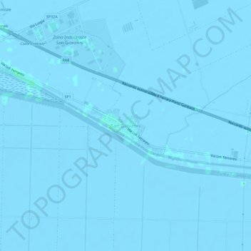
Name: San Giovanni topographic map, elevation, terrain.
Average elevation: -2 m
Minimum elevation: -6 m
Maximum elevation: 4 m
Make a donation
Gear up for your next adventure:
As an Amazon Associate, this site earns from qualifying purchases at no extra cost to you.
Other topographic maps
Click on a map to view its topography, its elevation and its terrain.
Jolanda di Savoia
Italien > Emilia-Romagna > Ferrara
Auf dem Gebiet der Gemeinde befindet sich im Weiler Contane der tiefste Punkt Italiens. Die Höhe wird auf Karten des Militärgeographischen Institut Florenz mit 3,44 m unter NN angegeben.
Average elevation: -2 m
Codigoro
Italien > Emilia-Romagna > Ferrara
1224 überließ der Abt von Pomposa die Gemeinde Codigoro dem Herzog Azzo d'Este und gestand ihm das Recht zu, den Bürgermeister ernennen zu dürfen. Mitte des 15. Jahrhunderts, als sich die politische und kulturelle Ausstrahlung und Glanzzeit der Abtei von Pomposa allmählich ihrem Ende zuneigte, erbat der…
Average elevation: -2 m
Make a donation
Gear up for your next adventure:
As an Amazon Associate, this site earns from qualifying purchases at no extra cost to you.