Geolocate

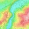
Xhoffraix topographic map

Click on the map to display elevation.

About this map

Name: Xhoffraix topographic map, elevation, terrain.

Location: Xhoffraix, Malmedy, Verviers, Liège, Wallonia, 4960, Belgium (50.43667 6.05020 50.47667 6.09020)

Average elevation: 507 m

Minimum elevation: 344 m

Maximum elevation: 605 m

Other topographic maps

Click on a map to view its topography, its elevation and its terrain.

Bévercé

Belgium > Liège > Verviers > Malmedy

Average elevation: 510 m

Bévercé

Belgium > Liège > Verviers > Malmedy

Average elevation: 510 m

Rocher de Falize

Belgium > Liège > Verviers > Malmedy > Bévercé > Falize

Average elevation: 382 m

Gear up for your next adventure:

🥽UV Protection Sunglasses - Protect eyes on bright days
🔌Travel Adapters - Essential for visitors to charge gear in Ireland
🧯Compact Fire Extinguishers - Safety for campervans and expedition vehicles
🏃‍♀️Running Hydration Belts - Hydration on the go for runners
🩹First Aid Kits - Essential kits for outdoor safety

As an Amazon Associate, this site earns from qualifying purchases at no extra cost to you.