
Thank you for supporting this site ❤️
Make a donation
Make a donation
Gear up for your next adventure:
As an Amazon Associate, this site earns from qualifying purchases at no extra cost to you.
Rugando topographic map
Click on the map to display elevation.
Thank you for supporting this site ❤️
Make a donation
Make a donation
Gear up for your next adventure:
As an Amazon Associate, this site earns from qualifying purchases at no extra cost to you.
About this map
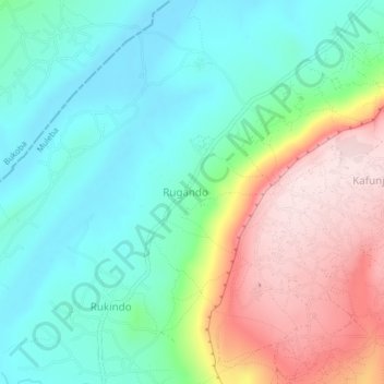
Name: Rugando topographic map, elevation, terrain.
Location: Rugando, Muleba, Kagera, Lake Zone, 78 KAMACHUMU, Tanzania (-1.62708 31.55899 -1.58708 31.59899)
Average elevation: 1,321 m
Minimum elevation: 1,191 m
Maximum elevation: 1,575 m
Thank you for supporting this site ❤️
Make a donation
Make a donation
Gear up for your next adventure:
As an Amazon Associate, this site earns from qualifying purchases at no extra cost to you.