
Little Exuma Island topographic map
Interactive map
Click on the map to display elevation.
About this map
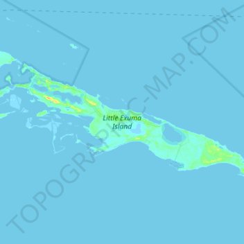
Name: Little Exuma Island topographic map, elevation, terrain.
Location: Little Exuma Island, Exuma, The Bahamas (23.40147 -75.65885 23.46449 -75.51754)
Average elevation: 1 m
Minimum elevation: -3 m
Maximum elevation: 24 m
Other topographic maps
Click on a map to view its topography, its elevation and its terrain.