
Thank you for supporting this site ❤️
Make a donation
Make a donation
Gear up for your next adventure:
As an Amazon Associate, this site earns from qualifying purchases at no extra cost to you.
Olto topographic map
Click on the map to display elevation.
Thank you for supporting this site ❤️
Make a donation
Make a donation
Gear up for your next adventure:
As an Amazon Associate, this site earns from qualifying purchases at no extra cost to you.
About this map
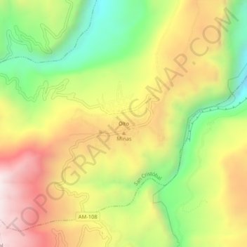
Name: Olto topographic map, elevation, terrain.
Location: Olto, San Cristóbal, Luya, Amazonas, Perú (-6.12039 -77.98001 -6.08039 -77.94001)
Average elevation: 2,470 m
Minimum elevation: 1,959 m
Maximum elevation: 2,995 m
Thank you for supporting this site ❤️
Make a donation
Make a donation
Gear up for your next adventure:
As an Amazon Associate, this site earns from qualifying purchases at no extra cost to you.