
Simpson Bay topographic map
Interactive map
Click on the map to display elevation.
About this map
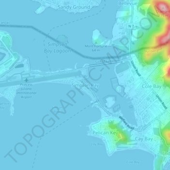
Name: Simpson Bay topographic map, elevation, terrain.
Location: Simpson Bay, Sint Maarten (Netherlands), 46226, Netherlands (18.01968 -63.11724 18.05968 -63.07724)
Average elevation: 14 m
Minimum elevation: -2 m
Maximum elevation: 244 m