
Dnieper topographic map
Interactive map
Click on the map to display elevation.
About this map
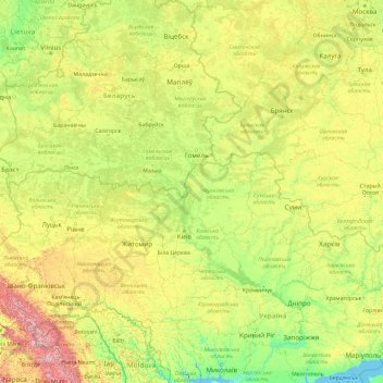
Name: Dnieper topographic map, elevation, terrain.
Location: Dnieper, Ripky Raion, Chernihiv Oblast, 74987, Ukraine (46.48514 30.02095 55.87170 35.19711)
Average elevation: 194 m
Minimum elevation: -8 m
Maximum elevation: 1,978 m