
Thank you for supporting this site ❤️
Make a donation
Make a donation
Gear up for your next adventure:
As an Amazon Associate, this site earns from qualifying purchases at no extra cost to you.
Alfaix topographic map
Click on the map to display elevation.
Thank you for supporting this site ❤️
Make a donation
Make a donation
Gear up for your next adventure:
As an Amazon Associate, this site earns from qualifying purchases at no extra cost to you.
About this map
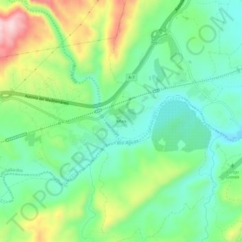
Name: Alfaix topographic map, elevation, terrain.
Location: Alfaix, Los Gallardos, Almeria, Andalusia, 04280, Spain (37.12289 -1.97908 37.16289 -1.93908)
Average elevation: 160 m
Minimum elevation: 63 m
Maximum elevation: 354 m
Thank you for supporting this site ❤️
Make a donation
Make a donation
Gear up for your next adventure:
As an Amazon Associate, this site earns from qualifying purchases at no extra cost to you.