Montier-en-l'Isle topographic map
Interactive map
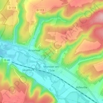
Click on the map to display elevation.
About this map
Name: Montier-en-l'Isle topographic map, elevation, terrain.
Average elevation: 218 m
Minimum elevation: 148 m
Maximum elevation: 308 m

Click on the map to display elevation.
Name: Montier-en-l'Isle topographic map, elevation, terrain.
Average elevation: 218 m
Minimum elevation: 148 m
Maximum elevation: 308 m