
Thank you for supporting this site ❤️
Make a donation
Make a donation
Gear up for your next adventure:
As an Amazon Associate, this site earns from qualifying purchases at no extra cost to you.
Atotonilco topographic map
Click on the map to display elevation.
Thank you for supporting this site ❤️
Make a donation
Make a donation
Gear up for your next adventure:
As an Amazon Associate, this site earns from qualifying purchases at no extra cost to you.
About this map
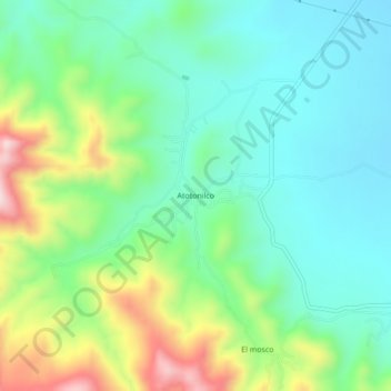
Name: Atotonilco topographic map, elevation, terrain.
Location: Atotonilco, Ciudad Fernández, San Luis Potosi, Mexico (21.97379 -100.46186 22.01379 -100.42186)
Average elevation: 1,354 m
Minimum elevation: 1,229 m
Maximum elevation: 1,647 m
Thank you for supporting this site ❤️
Make a donation
Make a donation
Gear up for your next adventure:
As an Amazon Associate, this site earns from qualifying purchases at no extra cost to you.