
Thank you for supporting this site ❤️
Make a donation
Make a donation
Gear up for your next adventure:
As an Amazon Associate, this site earns from qualifying purchases at no extra cost to you.
Talamantes topographic map
Click on the map to display elevation.
Thank you for supporting this site ❤️
Make a donation
Make a donation
Gear up for your next adventure:
As an Amazon Associate, this site earns from qualifying purchases at no extra cost to you.
About this map
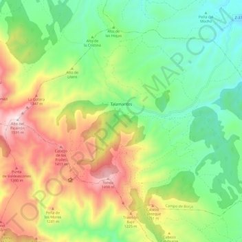
Name: Talamantes topographic map, elevation, terrain.
Location: Talamantes, Campo de Borja, Zaragoza, Aragon, Spain (41.69151 -1.72737 41.75784 -1.61402)
Average elevation: 1,010 m
Minimum elevation: 667 m
Maximum elevation: 1,567 m
Thank you for supporting this site ❤️
Make a donation
Make a donation
Gear up for your next adventure:
As an Amazon Associate, this site earns from qualifying purchases at no extra cost to you.