Geolocate

Springfield topographic map

Click on the map to display elevation.

About this map
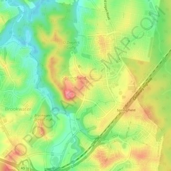
Name: Springfield topographic map, elevation, terrain.

Location: Springfield, Ipswich, Brisbane, Queensland, Australia (-27.67459 152.89350 -27.63686 152.92472)

Average elevation: 62 m

Minimum elevation: 20 m

Maximum elevation: 109 m

Other topographic maps

Click on a map to view its topography, its elevation and its terrain.

Gear up for your next adventure:

🧺Quick-Dry Hiking Towels - Space-saving towels for wild swimming or camping
🐦Irish Bird Guides - Spot coastal and mountain birds during your hike
🚨Emergency Whistles - Safety whistles for hikers
🔋Lithium Batteries - Best performance for digital devices in cold weather
🔭Portable Monoculars - One-handed optics for quick route checking

As an Amazon Associate, this site earns from qualifying purchases at no extra cost to you.