
Coudeyras topographic map
Interactive map
Click on the map to display elevation.
About this map
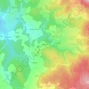
Name: Coudeyras topographic map, elevation, terrain.
Average elevation: 898 m
Minimum elevation: 760 m
Maximum elevation: 1,099 m
Other topographic maps
Click on a map to view its topography, its elevation and its terrain.
Chabreyras
France > Auvergne-Rhône-Alpes > Puy-de-Dôme > Échandelys
Chabreyras, Échandelys, Ambert, Puy-de-Dôme, Auvergne-Rhône-Alpes, France métropolitaine, 63980, France
Average elevation: 925 m