
Lac Cameron topographic map
Interactive map
Click on the map to display elevation.
About this map
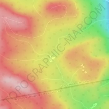
Name: Lac Cameron topographic map, elevation, terrain.
Average elevation: 537 m
Minimum elevation: 375 m
Maximum elevation: 638 m
Other topographic maps
Click on a map to view its topography, its elevation and its terrain.
L'Anse-Pleureuse
Canada > Québec > La Haute-Gaspésie > Saint-Maxime-du-Mont-Louis
L'Anse-Pleureuse, Saint-Maxime-du-Mont-Louis, La Haute-Gaspésie, Gaspésie–Îles-de-la-Madeleine, Québec, Canada
Average elevation: 111 m