
Thank you for supporting this site ❤️
Make a donation
Make a donation
Gear up for your next adventure:
As an Amazon Associate, this site earns from qualifying purchases at no extra cost to you.
Großnaundorf topographic map
Click on the map to display elevation.
Thank you for supporting this site ❤️
Make a donation
Make a donation
Gear up for your next adventure:
As an Amazon Associate, this site earns from qualifying purchases at no extra cost to you.
About this map
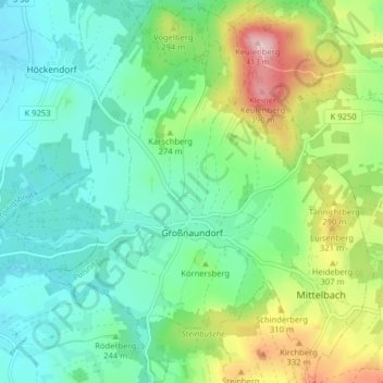
Name: Großnaundorf topographic map, elevation, terrain.
Location: Großnaundorf, Pulsnitz, Bautzen, Sachsen, Deutschland (51.18339 13.90074 51.23214 13.98037)
Average elevation: 254 m
Minimum elevation: 193 m
Maximum elevation: 401 m
Thank you for supporting this site ❤️
Make a donation
Make a donation
Gear up for your next adventure:
As an Amazon Associate, this site earns from qualifying purchases at no extra cost to you.