
东拉乡 topographic map
Interactive map
Click on the map to display elevation.
About this map
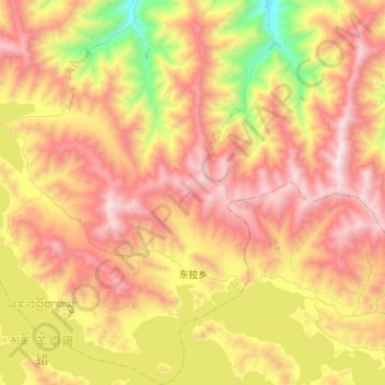
Name: 东拉乡 topographic map, elevation, terrain.
Location: 东拉乡, 贡嘎县, 山南市, Tibet, China (28.93898 90.61473 29.20357 90.91225)
Average elevation: 4,605 m
Minimum elevation: 3,720 m
Maximum elevation: 5,435 m