
Eastern Province topographic map
Interactive map
Click on the map to display elevation.
About this map
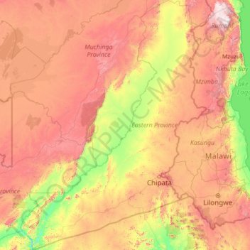
Name: Eastern Province topographic map, elevation, terrain.
Location: Eastern Province, Zambia (-14.99737 29.97946 -11.59088 33.54855)
Average elevation: 980 m
Minimum elevation: 388 m
Maximum elevation: 1,818 m