
Thank you for supporting this site ❤️
Make a donation
Make a donation
Gear up for your next adventure:
As an Amazon Associate, this site earns from qualifying purchases at no extra cost to you.
Var topographic map
Click on the map to display elevation.
Thank you for supporting this site ❤️
Make a donation
Make a donation
Gear up for your next adventure:
As an Amazon Associate, this site earns from qualifying purchases at no extra cost to you.
About this map
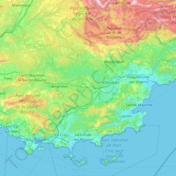
Name: Var topographic map, elevation, terrain.
Location: Var, Provence-Alpes-Côte d'Azur, Metropolitan France, France (42.98201 5.65603 43.80874 6.93324)
Average elevation: 324 m
Minimum elevation: -2 m
Maximum elevation: 1,886 m
Thank you for supporting this site ❤️
Make a donation
Make a donation
Gear up for your next adventure:
As an Amazon Associate, this site earns from qualifying purchases at no extra cost to you.